February 2024 will be a busy month for Anthony Acciavatti, Diana Balmori Assistant Professor at Yale School of Architecture. On February 2, he’ll deliver a talk on “Drawing Like a Tubewell: When Water Percolates and Oozes Through Soil” for the Program in Agrarian Studies colloquium series. That talk is the first in a series of engagements celebrating Groundwater Earth: The World Before and After the Tubewell, the Acciavatti-designed exhibition that will open at the Yale School of Architecture and run until July 6. Groundwater Earth “traces for the first timethe preposterous, practical, and perilous experiments with groundwater.” He’ll wrap up the month with a round table discussion on February 28 with Sunil Amrith, Renu and Anand Dhawan Professor of History. The discussion will cover the exhibition and the stunning geophysical, ecological, and social effects of groundwater extraction.
February is only one month of Acciavatti’s especially busy year. In March, he’ll take a class of 14 graduate and undergraduate students to India, where they’ll explore the megalopolis of Delhi, study the effects of the Green Revolution, and visit the Taj Mahal. Shortly after they return, on April 1, he’ll deliver a lecture on Groundwater Earth at the Yale School of Architecture. The materials and equipment used for one of his most significant works, Ganges Water Machine, a gargantuan project to build an atlas of the ever-changing Ganges River basin, were acquired by the Victoria & Albert Museum in 2023 for their new expansion, V&A East. They’ll go on display in April 2025.
On top of all of this, February will also see the release of a cookbook created by Acciavatti and student from his seminar ‘Labs and Landscapes of the Green Revolution.’ The cookbook is designed to explore the recipes and legacies of the Green Revolution on a global scale, touching on specific crops, new agricultural practices, and the harms and benefits of vastly increased agricultural production. A second and third volume compiling the work of students in the 2023 and 2024 classes, co-edited with Harshavardan Raghunandhan, will be released later this year.Given that Acciavatti seems to be everywhere, and doing everything, SASC was Unfortunately delighted to have the opportunity to catch up with him and talk about the carnival of events and projects he is headlining this year (and beyond). A condensed transcript of the interview is below.

Daevan Mangalmurti: What is Groundwater Earth about—and why the tubewell?
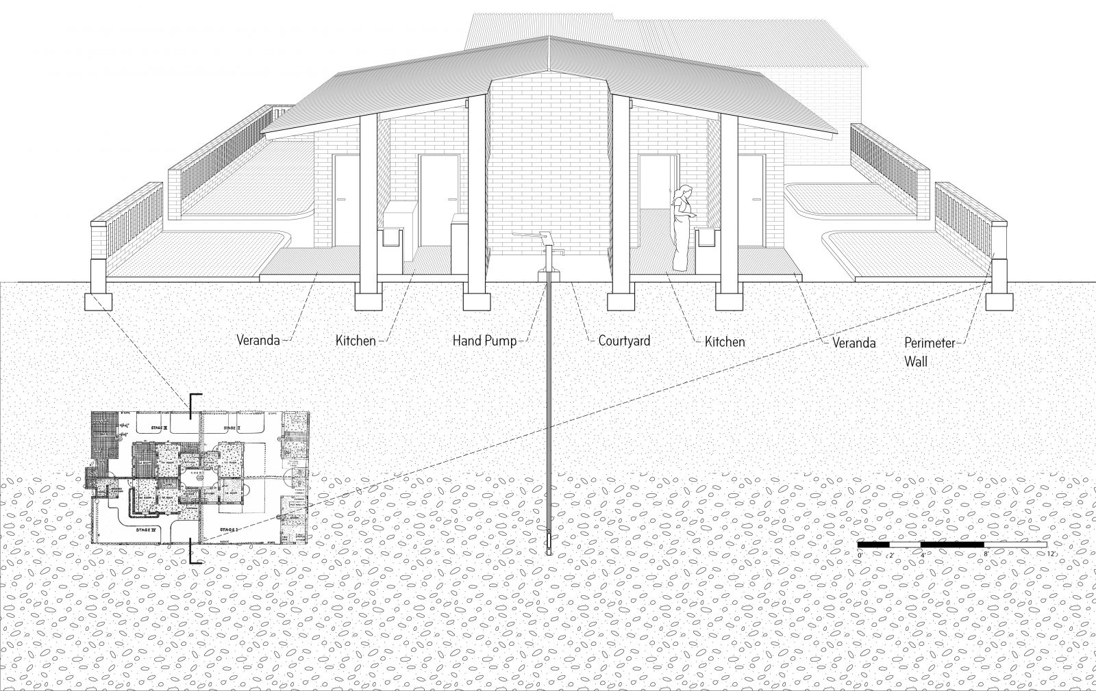
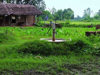
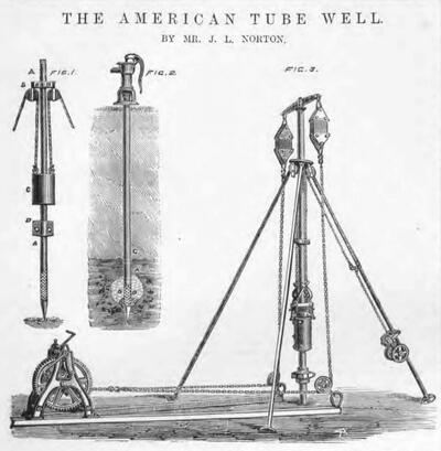
Anthony Acciavatti: Groundwater Earth looks at how the tubewell, this minor technology, has had global reach. It was patented in 1865 in the United States as a means of providing potable water for Union troops who were worried about Confederates poisoning surface water bodies like lakes and ponds. By the end of the 20th century, it’s gone global, primarily for potable water, but also for irrigation. This really small technology has been a means of extracting so much groundwater from the Earth that today we know it has changed the tilt of the Earth by a few centimeters and contributed to sea-level rise—which, of course, is actually quite big. Almost 50% of the world’s population drinks groundwater in some form daily, and more than half of agriculture is irrigated with it. Cities from Phoenix and Tucson to Mexico City, Dhaka, Delhi, Jakarta, and Addis Ababa also depend on extracting groundwater, much of it through tubewells.
The exhibition asks how the tubewell has started to change the surface of the Earth in terms of agricultural practices and human settlement, and how we might better understand the ways in which the subsurface is reshaping the surface and what that means for the future. The exhibition looks at four different conditions—the scales of the home, the neighborhood, the city, and the hinterland—in two geographies in particular: the Sonoran Desert of Arizona and Mexico and the Indo-Gangetic Plain of Pakistan, India, and Bangladesh.
The exhibition operates through a set of mock-up “core samples,” like a geologist’s, except that whereas in a geological core sample, the surface soil is at the top and the deepest layers at the bottom, ours are flipped 180 degrees. We hang these core samples from the ceiling, and as a result the architecture is itty-bitty versus the depth. So the exhibition is really about foregrounding groundwater and geological strata as the protagonists, not settlement. Beneath these core samples there are mirrors via which you can see the reflection of the spatialization of settlement and agriculture that’s in the model. But what you’re really looking at is the depth of all of these tube wells shooting through the core sample.
The last part of the exhibition is five perspective drawings of five cities with really important relationships to aquifers: New Delhi, Tucson-Phoenix, Jakarta, Mexico City, and Addis Ababa. What I’m particularly interested in is the fact that of course these places are very different politically, socially, even environmentally—but they have very similar patterns of urban growth and very similar relationships to agriculture.
DM: Each year, you take a class to India. What do these trips look like?
AA: This year we will start in New Delhi, where I always give a walking tour so that students get a sense of the many, many layers of the city. While at first the Delhi of the early 20th century commands a lot of attention and space, layered within that are many histories, going back to the Mughals, Delhi Sultanate, and earlier. We go, in particular, to baolis, or step-wells, to try to set them up for understanding the context of Delhi and how crucial water has been as a social and physical infrastructure.
 From Delhi we travel to Chandigarh to see the architectural work of people like Aditya Prakash, who worked on Chandigarh and then designed Punjab Agricultural University (PAU) in Ludhiana, an institution that was meant to create a new relationship between the science of the laboratory and the fieldwork of agriculture. We look at PAU and a number of other institutions, mostly in the Punjab, to understand the enduring legacies of the Green Revolution and the stories, heroic and critical, that are told about it. We travel entirely by bus so that students really get to see how much the landscape changes and how North India spreads in densities of agriculture and settlement. It’s a mosaic or patchwork, not a dichotomy of city and hinterland.
After Chandigarh we come to Gurugram, formerly Gurgaon, to see how it has been radically transformed from being a major site for agriculture to a technological hub, and then we travel to Agra to see the Taj Mahal and [the Mughal palace-city of] Fatehpur Sikri.
DM: Can you tell me about the materials the Victoria and Albert Museum acquired from you last year, some of which are more Mars rover than draftsman’s ruler?
AA: The Victoria and Albert Museum is opening up a new museum in East London in 2025, and they have been particularly focused on acquiring work engaged with the environment. The museum has acquired the instruments I made to map the Ganga, the drawings I made, the field work notes that I took, a number of sketchbooks, some physical models of infrastructure, and several thousand photographs of the 25,000 I took.
 I had gone to the Indo-Gangetic plains in 2005 in the hope that I might be able to look at contemporary maps of the region, but there were none, and satellite imagery was too low resolution. I knew there was no way I was going to map the whole basin, but what I did know was that different sizes of sediment can tell you a lot about the behavior patterns of a river. So, I became something of a Sherlock Holmes, sleuthing around, looking at different sizes of sediment, and noticing that they change as I moved out from the river channel. This wasn’t a uniform change from big to small or small to big, but a varying change. I tried a bunch of different things to collect these. Ultimately, I developed a rover, repurposed from a children’s remote-control car, that would use packing tape to collect soils. I also bought 100 pairs of white tube socks and would thrust them into the river channel at different places from Ganghotri all the way down to Bihar. The V&A actually acquired one of those as well—quite literally, a soiled sock.
I should say that using the wrong things for the right purpose is something I’ve done a lot. For instance, I scanned all of those rolls of packing tape, and then using the Magic Wand tool in Photoshop, I mapped out the soil. It was my own way of doing a kind of remote sensing using data I collected myself. The tools branch across geography, sedimentology, geomorphology, architecture, and maybe art as well.
DM: Thank you!
Byline: Daevan Mangalmurti


